On our way down the Ionian coast of Greece this week, Susie and I could not resist stopping at a few of the brown archaeological signs. In fact, we wanted to check out a few of the Venetian and Ottoman fortifications on this strategically important shore. In particular we wanted to see the Karavostasi fort near Syvota south of Igoumenitsa. We missed that fort, but like many of my stops to hike up to the top of a hill, we did get a chance to see Hellenistic fortifications.
I was particularly shocked to discover some perfectly good polygonal ashlar walls that I never visited on any American School of Classical Studies trip. The site fulfilled all the necessary criteria for a stop by the American School’s Magical Mystery Tour. They were situated atop a steep hill, overgrown in most places, stunning views, vague association with a historical event, and status as a known site. The site is known as Dymokastro. Hammond discussed the site and identified it with ancient Elina in the JHS of 1945. It overlooked the site of the Battle of Syvota between Corcyra and Corinth at the start of the Peloponnesian War in book 1 of Thucydides. Pausanias may have mentioned the sweet water of this site at 7.2.
In short, how did I miss this site on my few years tagging along with the American School’s Regular Program?
Here’s a view west across the sandy anchorage that Hammond refers to as “at the mouth of the Paramythia stream” or Vemokastro. The Corinthians seemingly established a base of operations here in the 430s to obstruct Corcyrean raiders.

The right flank of the battered Corinthian fleet retreated to this beach after the first day of the Battle of Syvota.

Here’s the view from Dymokastro (Hammond’s Vemokastro) of the straits between the mainland and the Ionian islands of Paxoi and Corcyra where the sea battle took place. The Paxoi are visible to the left of the sun and Corcyra to the left.

The fortification on Dymokastro is a good bit later, of course, dating to the Hellenistic period and excavated over a series of campaigns at the end of the 20th century.
There is ample room for a modern tour bus to idle by the side of the road while American School students scamper up the east side of the hill. As my wife and I made the steep, but not overgrown climb up to the summit (or high enough to understand where the summit was, take some photos, and descend), I could almost hear Merle Landgon’s voice (he was the Mellon Professor during my first year there) telling us that we had an (seemingly) impossibly short time to make the climb, visit the site, and be back on the bus. (According to my memory, Langdon would then vanish and appear – as if without exerting any effort – at the top of the hill and begin telling us the history of the site).
The walk rewarded us with more than just find views, but also a significant stretch of a well-preserved wall of polygonal masonry.


The top of the hill was less rewarding with an overgrown placard marking “private house”:

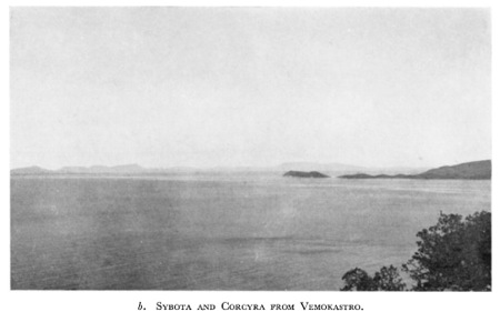
The views, however, are worth the walk. Paxos in the near foreground, Corcyra in the background, and the Syvota islands on the right.

Check out Hammond’s photo from the same point:

We also saw some nice purple flowers:


Great Post! I am an archaeologist traveling the world and it’s nice to see posts from someone who knows there history. I will be housesitting in Ayvalik, Turkey for a month this summer. Any recommendations for must sees on Lesbos?
I was at this site 3 weeks ago and there was much, much more to see on the acropolis. Not so overgrown as in your picture of the “private house”. By the way, I also came there more or less by accident because I usually follow the little brown signs. 🙂
Hajo,
Thanks for the update! They must have cleared the site after our visit!
Bill