Two Things Tuesday: Summers are for Survey Archaeology

This time of year my thoughts almost always turn to archaeology as my preparations for the summer research season begin to take on a sense of urgency and clash with the end of the semester rush.

For many years, this also meant that I started to think about survey archaeology and this meant, at least partly, preparing my body for the rigors of a summer field season. As I’ve gotten older, I’ve been lucky enough to be able to ramp down my involvement in active field projects and shift my attention to publishing the results of older excavations. That said, I still feel a bit of nostalgia for early morning departure times from the seaside at Myloi (in the Argolid), walking along the coastal plain at Pyla-Koutsopetria, and the smell of Eastern Corinthia as the heat of the day would start to infiltrate the citrus and olive groves.

This year, this nostalgia is particular acute thanks to two things and these make for a nice, if slightly maudlin, Two Things Tuesday.

Thing the First

I’m very excited to announce that we have a publication date for David Pettegrew’s book on the Eastern Korinthia Archaeological Project: Corinthian Countryside: Linked Open Data and Analysis from the Eastern Korinthia Archaeological Survey. The book will drop on September 1, 2024.

The book is an in-depth reading of the data produced from EKAS, an iconic, high intensity survey in the Eastern Corinthia that trained a generation of survey archaeologists in Greece (including myself, David, Dimitri Nakassis, and Sarah James among quite a few others!), spawned a series of successor projects, and forged lasting personal and professional relationships. 

David’s book digs deeply into the digital data, offers some compelling new conclusions, and most importantly presents a template for not only the reuse of EKAS data, but also the publication of data produced from other, similar projects across the Mediterranean. 

I’m serving as publisher on this project, and have read the entire manuscript multiple times. It is really exciting to see the final pieces of this publication project coming together (including it would seem an unlikely partnership with the American School of Classical Studies at Athens who have asked to be involved in the publication of this book). 

The last step in the process is the book cover which is coming together. I have two options right now of which I’m particularly fond:

I’m slightly partial to the front of the first cover and the back of the second one which shows the author standing at the round tower at Lychnari that we published almost 15 years ago, but I’m not sure that I want to disrupt the wrapped cover design on either of them. 

Thing the Second

I was also lucky enough to participate in one of EKAS’s sequel projects: The Western Argolid Regional Project directed by EKAS alumns—Dimitri Nakassis and Sarah James—and Scott Gallimore, a veteran of the active Cretan survey archaeology scene. I served as “Assistant to the Directors” and largely played the role of the grumpy field director.

During my time on the project, I spend countless hours in the fields and paths of the Western Argolid. Project director and my long time colleague, Dimitri Nakassis produced a nice blog post the other day introducing our newly published “results” article “Landscape Histories and Terrestrial Networks in the Peloponnese: Results from the Western Argolid Regional Project” in Hesperia 93.1 (2024). Go check out his blog post now.

Reading his post and our article reminded me of early morning departure from the seaside in Myloi (and I still wince a bit about oversleeping on the first day of the project’s first season and missing our field orientation!)
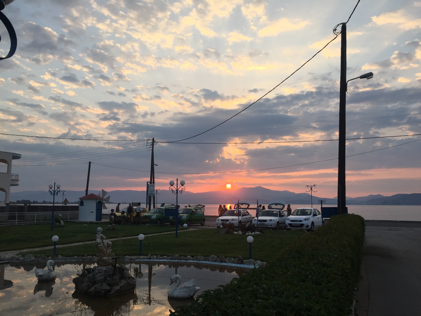
and evening walks over to the “Directors’ Mansion” for strategy meetings.

Of course, WARP reminds me of the The Bargepole (when he was Taco),

and the glories of the Rite-in-the-Rain notebook inscribed with Zebra pens.

When I think too long about WARP, my knees start to ache remembering the days spent walking across the cobbled strewn, deeply furrowed, and uneven fields of Inachos Valley.

It goes without saying that WARP has shaped my professional and personal life in meaningful ways and introduced me to a new group of colleagues and friends whose energy and smarts will shape the next generation of survey and excavation projects.

Summer will always be for survey archaeology in some sense, even if nowadays it’s mostly in my memories (and my aching joints).

20 Years at an Ancient Harbor on Cyprus

Today’s post is as much an advertisement as anything else and for that, as always, I apologize.

On Thursday evening, I’m giving a paper to the Friends of ASOR, which is a bit like the AIA lecture series. The paper will celebrate 20 years at the ancient harbor of Pyla-Koutsopetria on Cyprus and officially mark the transition from a project directed by myself, Scott Moore, and David Pettegrew, to one directed by Brandon Olson, Tom Landvatter, and Melanie Godsey. It also publicly marks the project’s transition from a focus on the Late Roman harbor town of Koutsopetria to the Hellenistic fortified site of Vigla. It loosely (cough) coincides with the completion of the second volume in the PKAP series which publishes the results of our excavations in 2008, 2009, and 2012. 

You can register for the event here for $13 which goes to help support ASOR. 

To keep the level of difficulty as high as possible, we’re dividing the talk into four sections: the first two will talk about the history of the site, the survey, and our study of Late Antiquity at the site; the second two will focus on past and ongoing excavations and the Hellenistic phase of the site. In other words, if you find my voice annoying and my ideas hackneyed, just wait a few minutes and someone else will be on your screen!

Here’s my little section of the talk and here’s a link to the powerpointer (as a PDF).

Twenty Years at an Ancient Harbor on Cyprus


The Survey, its Goals, and Results 

1. Goals

a. Develop the most representative sample of the ceramic signature Late Roman harbor town.

b. Determine whether some aspect of spatial patterning is discernible.

2. Slide 1: Scope and Method

a. 465 Units covering 99.5 ha

b. Most units on the coastal plain were 40 x 40 m

c. Slide 2: Surveyed at 10 m spacing

3. Slide 3: Artifacts

a. Total Artifacts: 37,883 total artifacts, which included 30,145 pottery sherds (80%), 6,924 tiles (18%), 109 lithic artifacts (.3%), and 705 other artifacts (1.9%): 902,875 kg (a US ton is 907185 g): a literal ton of pottery.

b. Distribution: artifact density of 2,960 artifacts/ha.

4. Slide 4: The vast majority of artifacts derived from the coastal zone and Vigla where artifact densities ranged from around 3,000 artifacts per ha to an insane 15,000 artifacts per ha. To put this in perspective, Sue Alcock once argued that 3000 artifacts per ha defined a site.

5. Much lower densities extending north from the coastal plain and in part of zone 2, which helped us define the likely ancient harbor.

6. Zone 3 extends to the north of the site atop the coastal heights. This area produced more pre-Roman material including an intriguing assemblage of Iron Age ceramics and fragments of figurines that hinted at the possible existence of an Iron Age sanctuary.

7. Slide 5: Vigla is largely Hellenistic-Roman, but there is a Roman signature as well. The site itself is almost entirely Hellenistic (as Brandon and Tom will discuss later).

8. Slide 6: Site of Kokkinokremos with its known Late Bronze Age site wasn’t an explicit focus of our work. While the vast majority of material from the site is contemporary with the known site there, there was a significant Roman signature that constituted 34% of the material including well known forms of ESA, ARS, CRS, LR1 amphora, and cooking wares. NOTE: excavations have not revealed traces of this R-LR assemblage.

9. Excavations, then, only tell part of the story…. what did survey tell us about the site of Koutsopetria.


Pre-Late Roman History of the Site

1. About 5% of the pottery from the survey area is post-prehistoric and pre-Late Roman (and most of it dates to the Hellenistic to Roman periods).

2. Slide 7: This suggests that the site began to emerge after the fall of the island’s independent city kingdoms.

3. Slide 8: For right now, we’re going to focus on the original research goals of the project and its focus on the Roman and late Roman.


The Late Antiquity Settlement

1. Slide 9: Around 40% of the material is Late Roman in date.

2. Slide 10: about 25% of this was Late Roman roof tiles

3. Slide 11/12: another 25% was likely Amphora or other utility ware sherds (and 5% of our total assemblage of Late Roman pottery was one particular type of amphora: Late Roman 1)

4. Slide 12/13: 10% of our pottery was fine or table ware much of it imported.

5. Slide 14: Olive Press fragments, fragments of brick masonry, gypsum thresholds, and abundant roof tiles suggests that the area was built up.

6. Confirmed our initial suspicious of this site a major Late Roman era site.

7. The abundance of LR1 amphoras which number in the thousands and a complex and massive assemblage of 6th and 7th century imported fine wares. This likely reveals our site as a regional emporium where agricultural produce from the area between the Roman cities of Kition and Salamis-Constantia made their way


A Church

1. Slide 16/17: Of course, we had our suspicions if for no other reason that Maria Hadjicosti and some of her colleagues from the Department of Antiquities has excavated parts of an early Christian basilica at the site over three short campaigns in the 1990s.

2. in 2008, we conducted additional excavations at the church in an effort to clarify its date and its history as well as to connect the building more closely to the surrounding site.

3. Slide 18: While today, the church is not much to look at — fragments of the apse and part of an annex room and hall way — even the small amount of it exposed through excavation tells us a tremendous amount about the site.

4. The fragments of the apse, however, reveal enough to let us know that church was most likely of a type common to the neighborhood of Salamis-Constantia suggesting that its ecclesiastical influence extended to the south coast of the island.

5. We were not able to date the construction of the church, but the design and the surrounding material make it obviously Late Roman in date.

6. Slide 19: Careful study of the architectural fragments from the church allows us to see that the church underwent several phases of refurbishment during its life. Windows were closed in and hallways were reconfigured.

7. Slide 20: We also found that the church remained in use at least until the 7th century when an almost complete ARS 105 plate was left on the floor of the annex.

8. Against the north wall of the annex room were the fragments of a Dhiorios cooking pot that might date as late as the 8th century. Maybe it was left behind by people stripping the church of its gypsum floor tiles.


Lessons from our work.


Slide 22: Our work is probably just the first word in the study of the Late Roman period at this site, but we like to think it is a substantial first word! It places our site on the map as a dynamic regional emporium that drew on drew agricultural production from region between Kition and Salamis. Once at the coast, the harbor likely served to move these goods to the Aegean region where they may have provisioned the army on the Danube. The existence of harbor facilities and surplus goods likely stimulated a market for imported fine ware ceramics which were found in such abundance at the site. These objects also help us tell the story of the church which likely served the local community and visiting merchants and mariners during what appears to have been an eventful life for the building and the site during Late Antiquity.

Caraher’s Corinthian Peripheries

It’s the first day of classes for the spring 2024 semester. As usual, I’m pretty excited about the start of classes, but I’m also satisfied that I got some work done over winter break.

First, I’ve produced a more or less complete draft of my paper on the Corinthian Periphery during the Roman period for some or another German volume on Early Christian Corinth. It was nice to dig back into some of the scholarship on the Roman period landscape of the Corinthia and try to produce some kind of synthesis. At the same time, it feels a bit like a “mediocre master’s thesis.”

I particularly struggled with what to cite. There’s so much scholarship on the Corinthia that I could have burned through a good bit of my word count in the footnotes. At the same time, I feel like the notes that I did include showed my “citational politics.” There was a clear bias toward “past and current Isthmians” (i.e. Caraher, Gebhard, Gregory, Pettegrew, Rothaus, and Rife) to the exclusion of folks who have worked on Roman material elsewhere on the Isthmus. I also tended to cite English language and synthetic works at the expense of excavation reports and Greek scholarship. This was a bit more deliberate as I imagined the audience for a volume like this is less interested in archaeology qua archaeology and more interested in gaining a better appreciation for the region. 

In any event, since whenever two people who work on the Corinthia are in the same room, there’s almost certainly some kind of beef (or at least delicious Peloponnesian pork), I suspect that some of my regular readers will find unforgivable omissions, glaring misstatements, and errors that reflect my true character.

I would, as always, appreciate any feedback, citations, and corrections. 

Here’s a prepublication copy: Caraher’s Corinthian Periphery.

Survey Archaeology and Modern Greece

One of the most fun aspects of the end of the semester rush is the feeling of one thing ending (the semester, winter, teaching) and another thing just straining to start. 

Right now, I’m thinking as much about my summer field season as wrapping up this semester. As part of that work, I’ve put together an abstract for the annual CHAT conference this fall which will be in Greece. The proposed paper will be co-authored with my friends Grace Erny and Dimitri Nakassis and is titled: “Survey Archaeology and Contemporary Greece.”

Here’s the abstract:

Over the past 50 years, Mediterranean intensive pedestrian survey introduced new forms of rigor to diachronic archaeological research in Greece. The chronological diversity of surface assemblages encouraged research questions that considered the transformation of landscapes and regions over the longue durée. In most cases, archaeologists calibrated their sampling strategies to produce spatially and functionally meaningful assemblages from often scant and scattered ancient artifacts in the plough zone. The abundance of twentieth and twenty-first century material in the Greek countryside, however, has posed challenges for prevailing collection strategies and interpretative schemes.


The Western Argolid Regional Project and the Eastern Korinthia Archaeological Survey both sought to document Modern material culture in ways that are both consistent with standard intensive survey practice. This work sought to improve our understanding of site formation processes, to document diachronic post-Medieval landscapes, and to develop methods suitable to the distinctive archaeology of Modern Greece. This paper will focus on a few case studies from our work in the Western Argolid and Eastern Corinthia that show the potential of intensive pedestrian survey to contribute to an archaeology of the Modern world. In particular, we argue that intensive survey methods provide significant insights into the diverse lifeways and built environments of rural populations in Greece across the turbulent political, economic, and social developments of the last 150 years.


Modern and Early Modern Greek Landscapes

Over the last few weeks, I’ve been distracted and honestly a bit fried. I feel like just keeping on top of my classes and shooting the wolf closet to the sled was about all I could muster. I did, however, carve out some time to read Faidon Moudopoulos-Athanasiou’s book on the archaeology (and history) of the Zagori: The Early Modern Zagori of Northwest Greece: An Interdisciplinary Archaeological Inquiry into a Montane Cultural Landscape (2023).

As a little side note: Sidestone Press does make the book available as a PDF at a really reasonable cost of $15 which is more than fair for a book that is well designed and lavishly illustrated. Some of the photographers are fantastic! More than that, you can read the book for free on their website. Check it out here

The book is sweeping and complex and represents not only Moudopoulos-Athanasiou’s immersion in the local landscape, but also his familiarity with a wide range of local histories, ethnographic sources, and archival material. Through these sources he produces a new history of the region from the 15th century though the late-20th, that is attentive to both the material remains of the past as well as the recent efforts to make the region a tourist and natural heritage landmark. 

The book is good and represents another meaningful contribution to the recent wave of significant work on the Greek landscape. As per my usual practice, I’m not going to review this book, but highlight a few things that made it compelling to me:

1. Walking. One of the most striking things about Moudopoulos-Athanasiou’s is his forthright attitude toward the challenges of doing fieldwork in a region that is rugged and afforested. He makes clear that most topographic and even economic knowledge of this landscape came from individuals who gained their understanding of the region on foot. To make sense of the historical landscape, then, required an appreciation of how one might engage the region on foot. Walking the landscape as a modern archaeologist offered one perspective on this historical knowledge. That said, Moudopoulos-Athanasiou made clear that this was not an appeal to a kind of ahistorical phenomenology, but rather another contributing element to a grounded understanding of region which is nothing without an appreciation of how various agents produced past and present knowledge. 

2. Economies. Among the most useful (and familiar) narrative in the book is a solid regional understanding of Zagori’s economic development. Despite the seeming isolation of the region and its tradition of local independence politically, Moudopoulos-Athanasiou shows that settlement and land use in Zagori developed in response to economic stresses   originating in provincial centers — in this case Janina — and in some cases stretching beyond the Mediterranean region itself. At the same time, Moudopoulos-Athanasiou recognized that local responses to these stresses by both the elites and the peasants who made the Zagori home. In particular, Moudopoulos-Athanasiou connects the monetization of taxes to the increased mobility of the local population and demonstrates that 19th century travelers whose remittences shaped so much of the region’s architectural and artistic flourishing, were an expression of the same forces that promoted movement from mountain villages to Ottoman çiftliks or as transhumant pastoralism.  

3. Elites. One of my favorite elements of Moudopoulos-Athanasiou’s book is his discussion of the continuity among local elites. He manages to trace the status of local elites from the end of the Byzantine Despotate of Epirus through the rise of Ali Pasha in Janina (and beyond). In this context, the vaunted independence of the Zagori region appears to have less to do with the persistence of a kind of indefatigable autochthonous Orthodoxy and Hellenic culture (and long-held trope familiar to anyone who has studied the emergence of Greek nationalism) and more to do with the persistence of a class of elites whose political allegiances sought to preserve their positions of power. 

4. Local Knowledge. Moudopoulos-Athanasiou demonstrated a remarkable familiarity with local archives, interlocutors, folk stories, and histories. This is understandable, of course, because his family comes from the region and in good ethnographic fashion, he resided in the region for a long stretch of time owing to the COVID pandemic. He recognizes when local narratives have absorbed national or regional ones while at the same time finding utility in unpacking some of the more distinctive stories told by residents of the region. As a completely unprofessional aside, I found the stories in the book to be fascinating and in some cases charming!  

5. Early Modern Landscapes. As someone interested in Modern and Early Modern landscapes, Moudopoulos-Athanasiou’s book is a great case study for how to approach modern landscapes as both artifacts of the priorities of the Greek state and as palimpsest for unpacking the regional level settlement and economic concerns. His grasp of both the local situation and the larger historiography of “post-Byzantine” archaeology is Greece is really great and makes my modest efforts to contribute to the archaeology of Modern and Early Modern Greece look one sided (if harmlessly so) by comparison. 

More on Survey Archaeology

Michael Given has long been one of my heroes among survey archaeologists. His work with the Troodos Archaeological and Environmental Survey Project remains to my mind the gold standard for a large intensive survey project. So when he writes about survey, it doesn’t take much for me to pay attention.

Given’s article “Towards a Post-Survey Landscape Archaeology” appears in Sturt W. Manning’s edited volume Critical Approaches to Cypriot and Wider Mediterranean Archaeology which I believe is a kind of festschrift for Bernard Knapp. It offers a sweeping view of the last fifty years of intensive pedestrian survey and demonstrates the well-known disconnect between processual, method driven field projects, phenomenological approaches to understanding historical landscapes, ecological and environmental approaches, and greater emphasis on community oriented disciplinary practice. The failure of these approaches to resolve themselves into a cohesive or integrated approach to survey has left intensive survey in a bit of holding pattern lately with an intensively methodological discourse in abeyance and a new way of talking is struggling to be born. 

I’ve been blogging about some this lately.

Given stresses that the interpretative space long occupied by methods and methodology, but turned over to concepts of convivial practices. On the one hand, this conviviality offers a model for understanding the interaction between members of a survey project, in the field, in the workroom, and throughout the analysis and interpretation process. On the other hand, conviviality represents the space of interaction between the various entities that constitution the archaeological landscape. In this context, conviviality embodied the interplay between artifacts, field conditions, climate, weather, team members, local residents, archeological policies, methods, tools, and non-human creatures. This expansive view of archaeological practice and landscape may sound ambitious and complex, but it also likely familiar to anyone who has spent time walking fields anywhere in the world. What Given suggests is that survey projects pivot from their longstanding preoccupation with methodology, and embrace ways of describing what we do that recognize the wide range of contingencies from climate change to soil types, archaeological policies, local residents, scents, and vegetation cover. This more expansive view of the landscape, which Given calls an entwined “socioecology” makes it possible for us to produce new relationships between the variables that shape not only the archaeological material recovered in the field, but also the broader context for its significance. I was particularly drawn to an approach that shifted our emphasis from the rather static concept of sites to the more dynamic idea of flows.

There are some great examples of this kind of more dynamic reading of landscapes. In particular, I’ve found Catherine Kearns’s The Rural Landscapes of Archaic Cyprus (2022) which strikes me as the kind of approach that Given envisions, although she grounds most of her analysis in the restudy of data from earlier surveys. That said, her interest in defining the rural as a way to understand the emergence of cities on Cyprus in the Archaic period relies upon an understanding of the countryside that goes well beyond the conventional depictions of urban and rural as static networks of entities tied to existing urban centers. Instead, she proposes a landscape defined by dynamic flows that often leave only ephemeral archaeological traces, but nevertheless reveal the shadowy period marking out the transition from one political, economic, and settlement regime and another. You can read my blog about it here.

(As an aside, if were the Journal of Mediterranean Archaeology, I would be tempted to do one of their review forums on Kearns’s book. It is not only significant for the archaeology of Cyprus, an area where the JMA already has significant reputation for publishing, but this book also has a chance to exert a  significant impact on how we think about intensive survey, ancient environments, and the organization of settlement in the ancient countryside.)  

This is particularly interesting to me as the Western Argolid Regional Project team is starting to organize the final stages in publishing their book length study of their work in the upper Inachos River valley. Part of my responsibility is to publish the Early Modern and Modern material with Grace Erny. Given’s thoughts on survey, particularly his comments on flow, got me thinking about the range of depositional processes and meanings present in these landscapes, especially since the distribution of modern material — especially ceramic rooftiles — is almost ubiquitous across the survey area. It is tempting to try to understand this material less as the manifestation for certain activities in countryside and more as the manifestation of both human and natural depositional flows. In some cases, these patterns will be obvious, such as the relationship of discarded tiles, for example, to existing roads. In other cases, we might have to use the depositional patterns to suggest the presence of flows that no longer leave traces in the landscape. My feeling — not having looked at the data for a few years — is that thinking in terms of movement in and through the landscape will be more productive than more site based interpretative paradigms.  

Surveying the Byzantine Corinthia

This is a bit of random post that is made possibly by the generosity of my buddy Dave Pettegrew. Last week, I helped him put the final touches on an article that pulls apart the low density scatter of Byzantine pottery across the Corinth. I mostly added some footnotes that connected Dave’s thoughtful and critical analysis to the data upon which it rested.

I’m excited enough about this to share it here on the ole blog for three reasons. First, it is a great example of how to allow a reader to drill down into survey data from the “dizzying heights” of interpretation and analysis. Second, it shows how thoughtfully collected, organized, and published data can provide a meaningful supplement to published reports. Instead of having to reproduce drawings and maps from the project, you can link to dynamic expressing of these illustrations and plans and this allows a reader to explore the situations and forms in their own way. Finally, this practice encourages — or at tempts — the reader to reuse this data in different ways either on the granular level of artifacts or the aggregated level of regional or even transregional analysis. By showing that the data is there and revealing how it is organized, other scholars can at least theoretically reuse this data in a thoughtful way.

1. Contexts. One of the coolest things about the EKAS data is that it’s organized in such a way that it’s possible to get a sense for field conditions in particular area. This means, you can compare, for example, the number and distribution of ploughed and unploughed fields across the survey area. Or look for units on the basis of a particular visibility. And with a bit of persistence combine the two: these are ploughed fields with 30% visibility in a particular area. If you want a real deep dive, you can even look at the geomorphological data from the survey area

Open Context Search Results 1 to 6 of 6 2023 02 02 05 40 15

2. Chronotypes. As readers of this blog know, the chronotype system was both a sampling strategy used by the survey as well as a naming convention that a number of other projects have since adopted. This allows us, for right now, to identify all the survey units were fragments of African Red Slip forms 104-106 appear or units that produced some of the few fragments of Early Medieval cooking pots. You can also drill down to see that Tim Gregory identified the two fragments of Early Medieval cooking pots 20 years ago (here and here) in survey unit DU 7612 and illustrated another example from the vicinity of Rachi Bossa in 2001.

3. Periods. It is not very hard to go from a particular chronotype, to material from a particular period. So here are all the “top order” chronotype periods from the survey area. Clicking on the Medieval chronotype period allows us to see all the material dated to that period and the various sub-period associated with this higher order period and the distribution of Medieval pottery in general. We can then, “dig deeper” to check out the distribution of Late Medieval material from the survey area. And we can look at all the specific example of Early Medieval pottery from the survey area. Or, this cute little fragment of an Ottoman/Venetian Sgraffito identified by Daniel Pullen in 2001 from the area of Perdikaria near Rachi Bossa. 

4. Regions, Zones, and Sites. In some ways, the ability to present information collected in a granular way in a granular fashion is not all that remarkable. After all, projects have long released their data in various spreadsheets that allowed savvy scholars to understand what projects recorded. 

What’s more interesting is how we can aggregate data in interpretative meaningful ways. For example, David identified an early Medieval site on the slope of Mt. Oneion near a modern church dedicated to Ay. Paraskevi:

EMED 1: Ayia Paraskevi (Zone 38), on the lower slopes beneath Mt. Oneion, lay just above the road from Kenchreai about two kilometers west of the harbor. Early Medieval fine ware sherds were found in five (of ten) survey units covering an area of 220 x 220 meters. The eight rims, bases, and handles represent green and brown painted ware, measles ware, and glazed fine ware; three of these artifacts can be dated to the eleventh to twelfth century. The Early Medieval presence here reoccupies a probable Late Roman villa site inhabited at least into the seventh century.

We can check out the material from this area here and from “Zone 38” here and the Early Medieval artifacts from that area here and the Late Roman artifacts here

David also identified some Late Medieval sites in the survey area. After acknowledging that the in general, the low density of Late Medieval material in the survey area belies its not insignificant quantity, he identified several low density sites. 

For example:

LMED 11 (Zone 47). The site of Ano Vayia generated two fragments of Late Medieval coarse ware. 

Once again, we can identify this site spatially by zone and by region. We can locate the two Late Medieval sherds from this zone. And then pull up the two artifacts: here and here. It’s useful to note that once again Tim Gregory identified this material in 2003 and that these two artifacts are available for restudy at Isthmia. It is also notable that we mentioned this material in a 2010 publication which you can check out here.


What David has done with this survey data isn’t particularly unique, but it does get exciting when we think about how this kind of granular and aggregated data can form the basis for both a book length publication on the project (coming soon!) as well as the reuse of the data by other interested scholars.

What Time Is This Place (Part 1)

I have a phobia of reading old books. It’s irrational as most phobia are, but nevertheless guides my actions to an embarrassing extent. As a result, it took a particular nudge from my buddy Kostis Kourelis (and a generous copy of the book) to will myself to read Kevin Lynch’s What Time Is This Place? (MIT 1972). 

This book blew my mind. To make everything about me: this book was like a cross section of my recent interest in time, ruins, urbanism, campus life, and even teaching. It’s like I was simply living in a world sketched out by Kevin Lynch. 

The book in broad strokes is a meditation on time and place. Lynch fearlessly traces the role of time in our daily lives, our building environments, and, as you’d expect, our lived experiences. In particular, Lynch is interested in the experience of time as change.

Here are some running notes chapter to chapter. 

1. Cities Transforming. The first chapter considers change on the level of the city and the way in which people’s experience and idea of the city shaped the transforming of cities. It made me think a good bit about my work on the Grand Forks Historic Preservation Commission and our efforts to document (and in some ways influence) the transformation of the city of Grand Forks. For example, my wife and I produced a massive study of mid-century housing in the city that traced its transformation from a city largely anchored in its pre-war pedestrian plan to one defined by cars, post-war prosperity, and the rise of the suburb. You can read the report here

2. The Presence of the Past. This chapter is even more relevant for my wok on the GFHPC. It focuses on the role of ruins and material evidence for the past in creating a sense of presence in a community. This is literally the mission of the Commission, but as Lynch points out, one that is not as straight forward as preservation for the sake of preservation might allow. Over the past five or six years, we’ve talked more and more about the value of attempting to preserve and document buildings and districts not limited to the obvious or even elite building which often carry the burden of the past for a community. Instead, we have shifted at least some of our attention to apartment buildings, schools, commercial spaces, and (if I had my way) neighborhood bars that preserve the workaday landscapes of the city. We’ve also talked more about how to make present a past that has disappeared as a result of the city’s floods, urban renewal, and social change. What do we do to inscribe the memory of these places into the urban fabric?   

3. Alive Now. Lynch’s brilliant contribution to urban planning is that he foregrounded the experience of the city and sought to create urban forms sensitive to the needs of an individual. In this book, he considers time as more than simply made manifest on a collective level (so that everything doesn’t happen at once), but also experienced individually. As readers of this blog might know, I am obsessed with time both personally through my modest collection of watches (or my collection of modest watches) and professionally through my work as an archaeologist. It is hardly surprising that I’ve been fixated on the concept of slow as not only an antidote to the sense of urgency that suffuses so much of our professional life, but also as way to make explicit the tension between clock time and the time of experience. 

4. The Future Preserved. When Kostis sent me this book, he made explicit reference to the world of Sun Ra who has become an obsession for me. For those of you unfamiliar with Sun Ra, he is one of the founders of mid-century Afro-futurism which he expertly grafted to afrocentric views of the Black past (as his name suggests). As Lynch recognizes in this chapter title, there is a crucial need to preserve the past not only as a way to remember past presents, but also to remember past futures. The growing interest in Afrofuturism reveals the potential of past futures to shape present futures and to make us aware of how we have and have not lived up to our aspirations (however well intended). It goes without saying that continued struggle for racial equality offers a sobering context for mid-century Afrofuturism. It is also a good reminder that as much as we cringe or even protest at pseudohistory, pseudoarchaeology, and other “false” views of the past, the line between false pasts and false futures is a fine one indeed and the goals of both projects tend to intersect in the messy politics of hope. 

5. The Time Inside. One of the more fascinating chapters of the book considers how our internal sense of time clashes with external constraints. Anyone whose body resists the tradition of eight continuous hours of sleep is familiar with this feeling. I’ve speculated on this as it applies to the length and rhythm of the academic semester. Lynch clearly recognizes that time is a factor in learning and how and when we learn, remember, and think various not only as individuals but also collectively. Last year, for example, I started to notice how student workloads, commitments, and time often doesn’t serve to advance student learning.  Instead, the time for student learning is a constantly negotiation of space, finances, and other commitments. This is inevitable, of course, but it nevertheless reinforces how the personal time of student experience is not entirely under their own control.  

I’ll come back with Part 2 tomorrow!

More on Rivers

This weekend, I read and enjoyed Donald Worster’s classic Rivers of Empire: Water, Aridity, and the Growth of the American West (1985). I read this as part of my effort to become a bit more familiar with American environmental history, but also get to understand the larger conversations surrounding “hydraulic society” in the American West. In many ways, Worster provides a key formative statement in how we understand the environmental manifestations of the United States’s quest for empire. By tracing the changing attitudes toward water and rivers in the American West from the 19th century to the mid-20th, we get to see the interplay between small farmers, wealth landowners, local communities, state governments, and the federal government in creating a new hydraulic society with both democratic potential and the capacity for exacerbating economic and social inequalities at a nationwide scale.

Some of this is also relevant for my growing interest in the flood mitigation efforts made along the Red River of the North. To be clear, Worster’s main focus was not only managing floods. In fact, flood management and navigation fell under the domain of the Army Corps of Engineers and Worster’s main focus was on the Bureau of Reclamation which sought to transform the rivers of the American west into a source of water for agricultural prosperity both in the region and nationally.

Worster’s understanding of American attitudes toward nature and to the flow of rivers, however, emphasized the desire of Americans to project their imperial yearnings not simply over the Indigenous people and territory of this vast region, but also of the rivers and natural resources. The earliest efforts were small scale and directed immediately toward the needs of communities struggling with the aridity of the region and the need to adapt their eastern crops and practices to irrigated farming.

By the early 20th-century, however, these limited and pragmatic approach quickly gave way to more expansive plans driven by competition and profit. At this stage the control of water and the ability to irrigate represented a pathway to wealth and wealthier landowners found ways to contravene efforts to preserve equality (or at very least fair) access to water in the West. As a result, control over water in the West soon took on the form of an ironic tragedy as the rhetoric used to champion increasingly bold and costly hydraulic interventions became increasingly detached from the outcomes of these intervention which rather than fortifying an idealized agricultural democracy, created more wealthy and powerful landowning class. The only commonality between rhetorical posturing of Bureau of Reclamation and the avarice of landowners was the desire to control the rivers of the West. 

How this all applies to my work here in the Red River of the North is bit unclear right now. Certainly there is reason to suspect that flood control along the Red River of the North is part of a larger effort to control western rivers in the name of stable settlement. The flooding of the river in the 19th century had revealed its destructive potential and floods in the 1950s, 1970s, and 1990s promoted increasingly monumental and ambitious interventions.

All this was done against the backdrop of the Pick-Sloan plan along the Missouri River which sought to control and harness the flow of the Big Muddy to irrigate farms, mitigate floods, and provide recreational opportunities. The destructive ambition behind the Garrison Dam, which led to the flooding of thousands of acres of the Fort Berthold Indian Reservation made clear that North Dakota was part of the larger mid-century hydraulic landscape of the American West punctuated by massive dams and large scale diversions. Even today, massive diversions of the Red River around Fargo-Moorhead and around Winnipeg reflect a persistent willingness to transform the region by controlling the flow of rivers. 

My interest in reading Worster’s book, then, is less to discern whether the particular conditions that shape the Red River of the North appear in his analysis. For most of the time that this book covers, the Red River is both too far east (climatically speaking) and relatively untapped for irrigation. At the same time, I suspect that areas on the margins of the American West found themselves particularly susceptible to the mentalities that developed in the wider region. If we see Worster’s book as much a commentary on shifting attitudes toward empire building in North America as it is a specific technocratic, bureaucratic, or even economic response to certain environmental conditions (and the claim that Worster’s work smacks of a healthy dose of environmental determinism have been greatly exaggerated), then the work to control the Red River of the North fits into wider pattern that by the middle years of the 20th century had largely become unhinged from any particular justification. This ensured that the broader Western mindset that guided the continued damming of western rivers to provide irrigation for crops that would not sell, electricity for towns that did not exist, and solutions to problems that did not exist, could be applied to marginal cases because there was no longer a tight connection between the problem, the solution, and the justification for the approach.

This is not to suggest that the flood mitigation efforts imposed on the Red River of the North weren’t adequate or technically appropriate. Instead, I’m hypothesizing that the approach by the Army Corps of Engineers to the Red River in Grand Forks reflects attitudes developed in very different circumstances elsewhere in the American West. 

Whether this proves to be the case will involve some deeper digging!

More New Work on Early Christian Attica

At the end of the semester, I tend to experience a bit of priority creep as the number of “do right now” projects (grading, end of semester deadlines, and so on) begins to encroach on the “do sometime soon” or “wouldn’t it be cool to do?” projects. That kind of ontological ambiguity which is only heightened by the symbolic weight of the end of the year and gnawing fatigue that comes from the end of a semester causes bad decision making.

All this to say, I kept reading around some of the very recent work on Early Christian Attica. 

Three more things as a follow up to my post from yesterday.

First, I finished reading chapter 6 titled “Aspects of Christianity in Athens, Attica, and Adjacent Areas” in Cilliers Breytenbach and Elli Tzavella new book, Early Christianity in Athens, Attica, and Adjacent Areas, from Paul to Justinian (1st-6th cent. AD) published by Brill as the first volume in a series called Early Christianity in Greece (ECG).

It’s a really nice synthesis of the archaeology, textual, and epigraphic data with a view toward producing the kind of study that would support comparative analysis of Christianization both in Greece and the wider Eastern Mediterranean world. This kind of generalizable study is particular commendable for a city like Athens where archaeologists have tended to celebrate its uniqueness (especially in the Classical period) and the number and intensity of excavations and the city’s 19th and 20th century history creates a sample that calls into question how representative the city would be even for the later periods. That said, the sober analysis of Breytenbach and Tzavella drawn from cemeteries, epigraphy, architecture, and texts reveals a region that underwent gradual conversion to Christianity (perhaps punctuated by episodes of violence). 

The attention to cemeteries and associate inscriptions, on the one hand, allows the authors to probe social and economic organization of the Christian community on a granular level by noting the prevalence of family burials and the range of professions named in Christian epigraphy. They could contrast this with the story of monumental architecture which traced the consolidation of worship, certain aspects of the economy, and ecclesiastical authority around church buildings. Whether churches absorbed the function of civic and pre-Christian cults or developed a completely distinctive range of functions is left to the reader to decide.

Second, one particularly useful observation made in Breytenbach and Tzavella’s work is that the absence of monasticism in Greece has perhaps been overstated. Epigraphic evidence from Athens, Megara, and Argos suggest that monastic communities did exist in Greece despite the absence of architectural evidence for monasteries. To be honest, fourth fifth century monasticism appeared across a wide wide range of architectural forms from rural villas to urban palaces, massive purpose built monasteries, and scattered, ephemeral, and informal hermitages across the Eastern Mediterranean landscapes. The absence of explicit material traces for monasteries in Greece is no more surprising than the absence of evidence for house-churches or other spaces associated with an emerging Christianity that had not fully accommodated its institutionalize shape.  

Third, I very much enjoyed Georgios Deligiannakis’s “From Paganism to Christianity in Late Antique Athens: A Re-Evaluation” in Ilinca Tanaseanu-Döbler and Leonie von Alvensleben’s Athens II: Athens in Late Antiquity (2020). Deligiannakis turns his keen eye to the evidence of Christianization at Athens and in Greece and argues that despite the privileged position that Greece has enjoyed in the history of ancient religion, the evidence for the Christianization of Greece does not appear to be much different from the process as experience elsewhere in the Eastern Roman Empire.

He makes a few keen observations that I think benefit any archaeologist serious about Christianization in Greece. First, he observes that the absence of chronological control over the construction of Early Christian churches in Greece makes them a poor indicator of Christianization as a diachronic process. The excavation of a house church in Messenia which may have remained in use into the fifth century reveals that Christian communities may have continued to meet in a wide range of spaces even as monumental basilica-style churches sprouted across the landscape. 

He also argues that, if we accept Mango’s proposed fifth-century date for the conversion of the Parthenon into a church (rather than the more conventional seventh-century chronology), this changes significantly how we see the Christianization of Athens. Rather than assuming that the pagan cult practices tenaciously hung out against a Christian onslaught, it suggests a city that recognized its pagan past as part of its Christian present and rather than seeking to erase pre-Christian monuments sought to integrate them into the Christianized symbolic and ritual landscape. This finds parallels both in Greece (at Delphi and Olympia, for example, although these are not necessarily chronologically locked down) and at sites such as Aphrodisias in Anatolia which likewise saw a 5th century conversion of a temple.

That said, Deligiannakis points out that this doesn’t mean there were no episodes of violence between Christianity and paganism, but instead these appear sporadic and episodic. This not only proposed the kind of nuanced landscape that includes various individuals and groups with different levels of believe and commitments that manifests itself in different kinds of interactions. I was heartened to see that Deligiannakis took seriously my colleague Richard Rothaus’s work in the Corinthia (as well as Tim Gregory’s reading of the Christianization of Greece). 

There are a number of other interesting and useful pieces in the Ilinca Tanaseanu-Döbler and Leonie von Alvensleben volume including some that seek to survey recent developments (with particular attention to work done by Italian scholars) in the archaeology of Late Antique Athens. If this were to ever become a serious research concern for me, I am sure that I would eagerly devour these works. Even though that is unlikely at present, I will certainly consider the contributions in both of these volumes as I return to work in the Corinthia this spring.